English
 Español
 Deutsch
 日本語
日本語 Polska
 Français
 中國
中國 한국의
한국의 Українська
 Italiano
 Nederlands
 Türkçe
 Português
 Bahasa Indonesia
 Русский
 हिंदी
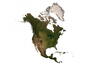
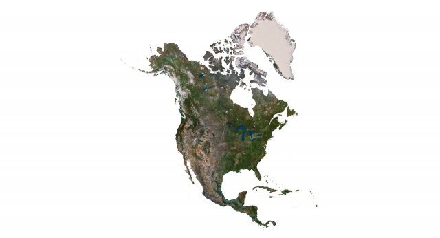
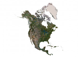
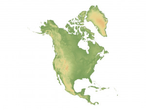
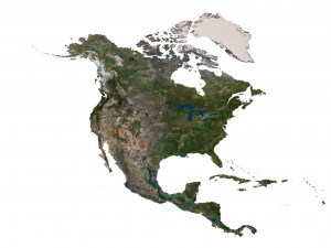
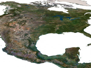
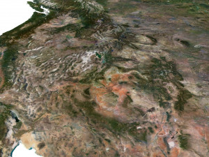
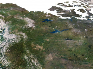
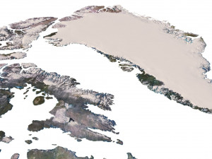
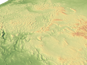
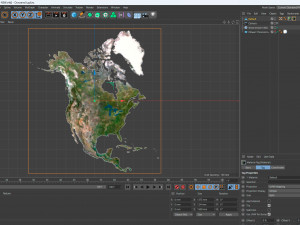
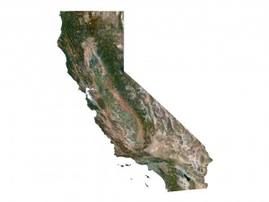
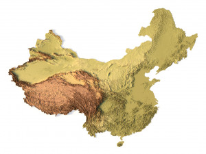
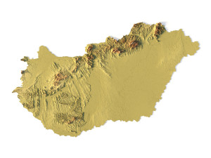
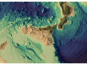
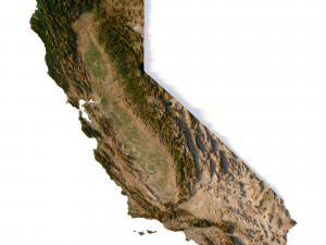
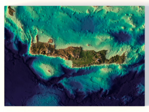
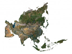
हिंदीNorth America Terrain 3D Map Modello 3D


-40%
c4d obj stl fbx
sychev23021983
Landscapes

- Formati disponibili: Cinema4D: c4d 426.10 MB
Render: Standard
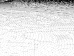
- Pligoni:9 984 852
- Vertici:4 996 900
- Animato:No
- Textured:
- Rigged:No
- Materiali:
- Low-poly:No
- Collezione:No
- Mapping UVW:No
- Plugins Utilizzati:No
- Stampa Pronta:No
- 3D Scan:No
- Per adulti:No
- PBR:No
- Geometria:Polygonal
- UVs Aperti:Unknown
- Visualizzazioni:1845
- Data: 2023-07-29
- ID Oggetto:456686
- Voto:
Format: C4D
File size (unzipped): 571 MB
Polygons: 9 984 852
Vertices: 4 996 900
Geometry: Polygonal Tris only
Model size: 1375 mm x 1500 mm x 1.34 mm
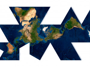
Projection: Mercator
Base: Open
Textures
Height Map TIF 7509*8192*16b - You can use this map in the displacement channel instead of the polygonal mesh.
Normal Map TIF 7509*8192*48b - Use this map to reveal fine details of the relief.
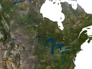
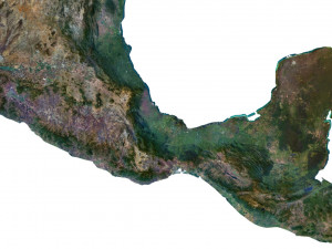
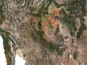
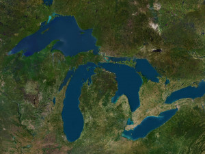
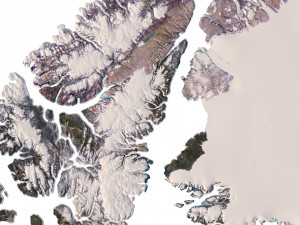
Satellite Map TIF 11000*12000*48b
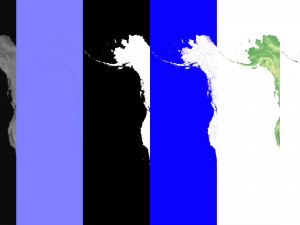
Water Mask TIF 11000*12000*48b - Use this map for masking in the Reflection channel to get glare from the water surface.
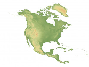
Pseudo-color Map 11000*12000*48b - Use this map to get elevation information based on the color shade.
Boundary Mask TIF 11000*12000*48b - Use this map as a mask for your background.
Other models can be made on request.
Modifications, conversion to OBJ, FBX, STL and other formats, more detailed models and better textures on request. Stampa Pronta: No
Leggi ulterioriFile size (unzipped): 571 MB
Polygons: 9 984 852
Vertices: 4 996 900
Geometry: Polygonal Tris only
Model size: 1375 mm x 1500 mm x 1.34 mm
Projection: Mercator
Base: Open
Textures
Height Map TIF 7509*8192*16b - You can use this map in the displacement channel instead of the polygonal mesh.
Normal Map TIF 7509*8192*48b - Use this map to reveal fine details of the relief.
Satellite Map TIF 11000*12000*48b
Water Mask TIF 11000*12000*48b - Use this map for masking in the Reflection channel to get glare from the water surface.
Pseudo-color Map 11000*12000*48b - Use this map to get elevation information based on the color shade.
Boundary Mask TIF 11000*12000*48b - Use this map as a mask for your background.
Other models can be made on request.
Modifications, conversion to OBJ, FBX, STL and other formats, more detailed models and better textures on request. Stampa Pronta: No
Hai bisogno di ulteriori formati?
Se hai bisogno di diversi formati, aprire un nuovo Ticket i Supporto e una richiesta per questo. Convertiamo modelli 3D a: .stl, .c4d, .obj, .fbx, .ma/.mb, .3ds, .3dm, .dxf/.dwg, .max. .blend, .skp, .glb. Non convertiamo scene 3d e formati come .step, .iges, .stp, .sldprt.!
Se hai bisogno di diversi formati, aprire un nuovo Ticket i Supporto e una richiesta per questo. Convertiamo modelli 3D a: .stl, .c4d, .obj, .fbx, .ma/.mb, .3ds, .3dm, .dxf/.dwg, .max. .blend, .skp, .glb. Non convertiamo scene 3d e formati come .step, .iges, .stp, .sldprt.!
Scaricato North America Terrain 3D Map Modello 3D c4d Da sychev23021983
north america landscape terrain country relief geography continent mountain earth map topography topo height elevation atlasNessun commento per quest'oggetto.